Putao
Putao
Adventure Trekking & Hiking
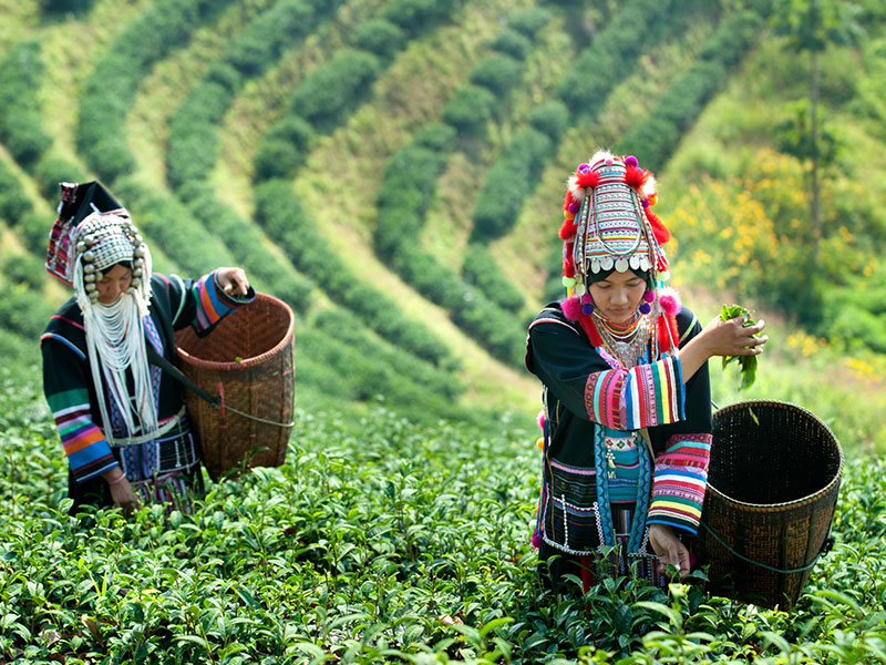
Rawan, Lisu, Jingphaw and Kachin people are represented in the region. A wide variety of species of orchid and other exotic flora and fauna are native to Putao. Flowing streams and rivulets, straw-roofed houses and fences of pebbles and creek stones provide a pleasant, pastoral contrast to the scenes and sights of modern cities. The suspension bridges are the typical river crossing in this region.
This area is famous for its Nature of originated Flora, especially there are many various kinds of orchids and even the world rarest Black orchids can be found in this area. And for fauna, one of the rarest animal species, Takin (Budorcas Taxicolor), Red Panda (Ailurus Fulgens), Black Bears, Black Deer, are all endemic to this region.
Around Putao
Mt. Hkaborazi
Mt. Hkakabozi, located in the northern Myanmar near the Chinese border, is 5885.3 meters high. It is the highest mountain in South East Asia, where the peak is enclosed within National Park to get to the bottom from Putao, it approximately takes 30 daystrekking. In 1997, it was for the first time conquered by a team of Myanmar and Japanese climbers.
Myitkyina
Myitkyina is the capital city of Kachin State, and Bamaw (Bhamo) the second largest city. Myitkyina and Bamaw (Bhamo) are reachable by flight or car. The Kachin people are one of the eight major ethnic groups, who are hill tribes. There are many other tribes in Kachin State. They speak their own dialects and wear their own dress. The people are mostly Christians.
Kachin State shares common border with China. The climate is cool. It is famous for the confluence of the Maekha and Malikha ravines, where the epic Ayeyarwady River. The confluence is about 21 miles by car from Myitkyina and is a famous tourist spot with idyllic landscapes, Pharkamt Jade Mines and Pidaung Game Sanctuary near Myitkyina and the Manao Festival which is very spectacular. There had been brutal fighting between the Allied forces and Japanese forces during the World War II, especially at the area along Ledo Road, which etches out a way through the rocky mountain region. There are about 20 War-time aerodromes in Myitkyina area. Please read the Last Plane from Myitkyina, written by a foreigner who had experienced the invasion by the Japanese forces in Myitkyina. Below Myitkyina, there is the first defile (gorge) of the Ayeyarwady. Mt. Hkakabo Razi (5889 m) is in the northern-most region of Kachin State. The snow-capped peak was first conquered by a Japanese expedition team in the year 1996. Hence Kachin State is a place worth visiting, without which your visit to Myanmar would be incomplete.
OTHER DESTINATIONS

Quick Links
- About Us
- Social Responsibility
- MICE Tour
- Popular Tour
- Our Local Events
- Discover Myanmar
Let's get contact
To get in touch with us about any enquiry, suggestions or information, fill out this form or email [email protected]
Newsletter
- Careers
- Terms and conditions
- Privacy Policy
We accept payment by:


